- That the West Coast has an amazing density of high quality rivers (as defined by their scores in the WCWKS2010)
- That - other then the Buller Earthquake section which is more commonly associated with Murchison - the most popular rivers are in the central West Coast area. The Kakapotahi, the Hokitika and the Arnold are the most commonly visited here
- That wilderness trips are popular in northern Buller (Oparara, Karamea, Mokihinui) and South Westland (Landsborough and Waiatoto but also Burke, Waipara and Cascade with the few who've paddled them)
- That the West Coast is commonly seen as the pinnacle of kayaking in NZ and rated highly amongst the world's kayaking destinations. It is valued in general for diversity of whitewater challenge, spectacular scenery, clean water and for the added interest of using helicopters to access many rivers
- That kayakers come to the West Coast from all over the world (28% from overseas) and more Cantabrians paddle here than West Coasters. They tend to be university educated.
28 December 2010
survey results
The info's all here, but how I get it 'there' is something I'm still working on! What does it show?
21 August 2010
Survey analysis
I'm just home from Lincoln Uni. Awesome help from Ken Hughey to start making sense of all this data. 443 entries multiplied by all the numbers that those people entered, plus the open-ended questions...is huge.
Some quick snippets, focusing on "who kayaks here":
81% of respondents were male
72% were from New Zealand, with Canterbury having the highest return rate at 32% of NZers (West Coast 2nd with 27% then Bay of Plenty with 10%)
66% were employed full time and 18% were students
the most common income bracket was $70000-100000/year (really!)
69% were involved in some form of voluntary work
55% of respondents had been kayaking for over 10 years and 43% preferred grade 4-5 whitewater
Working this week on graphing the river data and making maps.
08 June 2010
Coming soon: West Coast NZ Rivers Survey 2010
That's right, the crux of my work this year will be launched 1st July...
the West Coast NZ Whitewater Kayaking Survey 2010.
The survey is for anyone 18 or over who's kayaked on New Zealand's West Coast whitewater rivers. Why 18 or over? This will be an 'ethics committee approved' survey which means I've had to take several measures to ensure it's conducted properly. If you're under 18 and want to have your say, I'd love to hear your views on West Coast rivers, though what you tell me cannot form part of the results of this survey.
The survey will ask people what it is about kayaking that they're in to, then a section on what they think of West Coast rivers, then a bit about themselves.
 What will I use it for? I'll be able to see what patterns of use happen here on the West Coast - where people come from to use the rivers, how many and what they think of them. That will help DoC to make smart decisions where West Coast rivers are affected and might help kayakers to deal better with other groups who affect rivers such as hydro developers.
So the survey needs you!!!!
Please get the word out there. Follow this blog, join me on Facebook (Andy England on Facebook) or get in touch by email (westcoastwhitewater@gmail.com)
the West Coast NZ Whitewater Kayaking Survey 2010.
The survey is for anyone 18 or over who's kayaked on New Zealand's West Coast whitewater rivers. Why 18 or over? This will be an 'ethics committee approved' survey which means I've had to take several measures to ensure it's conducted properly. If you're under 18 and want to have your say, I'd love to hear your views on West Coast rivers, though what you tell me cannot form part of the results of this survey.
The survey will ask people what it is about kayaking that they're in to, then a section on what they think of West Coast rivers, then a bit about themselves.

So the survey needs you!!!!
Please get the word out there. Follow this blog, join me on Facebook (Andy England on Facebook) or get in touch by email (westcoastwhitewater@gmail.com)
01 June 2010
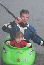
Paternity leave

Samuel, pictured right at about 3 hours old.
08 March 2010
South Westland river journeys
 As we pass Franz, then Fox, the valley sides get steeper and our necks crane harder to see the mountain tops. Rivers are the defining feature of every valley: glacially opaque or spring fed clear; meandering, braided or charging?
 The rain we had further north didn't touch the sides here, so the Turnbull is low and so is everything. We do the usual key chase for the Turnbull road and give up. Gareth rides his bike, boat over shoulder...
 Monkey Puzzle Gorge on the Martyr in hot sunshine is a physical chess game. More canyoning than kayaking, it gives us a new view of this river flowing through conglomerate rock.
 Back at DoC, we discuss the Cascade and the relative merits and drawbacks of 'wilderness areas' preventing kayak access by banning helicopter landing areas within map boundaries. I point out that the boundaries seem to take no account of river-based recreation, that helicopters taking in people who travel solely over river beds create hardly any impact. But 'Wilderness Area' is a high designation and not likely to change. The heart-clutching beauty of the Cascade River makes the argument important.
 I travel back a week later to the Waitoto, this time with rafts and kayaks aplenty. 2 Hughes 500s shuttle us in quickly and we set off to enjoy this scenery float. My birthday is spent with some old and new friends camped at a confluence, enjoying the finer things in life that rafts carry (Ledaig, in this case).
18 February 2010
Parties on the Perth

 It seems a while ago now but we had 2 days of massive groups on the Wanganui and Perth. Usually not my cup of tea, these days were magical with everyone in control and having fun.
 Although the rivers were low, there was plenty of whitewater and the scenery was awesome. We chatted to a group of about 15 trampers up the Wanganui who loved watching our kayaks float past and hadn't been bothered by the helicopters taking us in. In a time when I'm thinking about kayaking values, it was of note to me that the only marks we'd left were helicopter skid marks temporarily in gravel, while the trampers followed orange triangles along a worn trail and used permanent ladders to scale difficult parts.
I tried to get round people for interviews but it's proving to be impossible, so if you were there PLEASE do get in touch so we can keep in contact.
Cheers, Andy
05 February 2010
Getting to grips with this project
It may seem beyond belief, but it's hard to conceptualise my job this year at times. This week, I've paddled the Whitcombe and Hokitika Rivers on stunning sunny days with great people. Is this work? Well, I was taking extra safety measures to meet my risk management procedures, I stopped and photographed everything along with my Sony GPS to geotag everything. The Hoki, from Serpentine, took us from 0930 till 1800! That gave us plenty of time to enjoy the place and everyone was blown away by the gorges.
But I still worried that my work wasn't going anywhere or achieving anything. Then we stopped just upstream of the 'Gates of Argonath' and did a couple of recorded interviews. It started to come together and make sense: these are early days in a year long project, and the data I'm collecting will piece together to be a detailed snapshot of West Coast kayaking and rafting, the relationship between the people and the rivers.
If you're around and keen to paddle/meet/talk about rivers and what they mean to you, please get in touch:
westcoastwhitewater@gmail.com
Andy England on Facebook
0276856782
 Thanks for reading
But I still worried that my work wasn't going anywhere or achieving anything. Then we stopped just upstream of the 'Gates of Argonath' and did a couple of recorded interviews. It started to come together and make sense: these are early days in a year long project, and the data I'm collecting will piece together to be a detailed snapshot of West Coast kayaking and rafting, the relationship between the people and the rivers.
If you're around and keen to paddle/meet/talk about rivers and what they mean to you, please get in touch:
westcoastwhitewater@gmail.com
Andy England on Facebook
0276856782

29 January 2010
a bit more on what this is about...
I have a year off my teaching job to find out all I can about how important West Coast rivers are.
I was awarded a Teacher Fellowship by the Royal Society of New Zealand. I'll work with the Department of Conservation and Lincoln University to describe the significance of West Coast rivers to whitewater kayakers and rafters.
The first phase, right now, is to paddle as many West Coast rivers as possible taking geotagged photos of all key features (put in, gorges, major rapids etc). I then interview people about what the rivers mean to them, both in general and for named rivers. For example, do you go to the Arahura for whitewater or scenery, or both, or a social experience, or all of the above and which is most important?! Basically, we'll just have a chat and I'll figure it out later. The more people I can paddle with, the better the range of interviews I can get.
Hopefully, this should do 2 things: get a detailed record of what our whitewater rivers look like and find out what things kayakers/rafters value about them.
Then, over winter, I'll follow up all contacts with a survey to get some figures around what it is that we value. So any help in getting surveys out (and in) will be gratefully received.
What's in this for kayakers and rafters? Well, various decisions are made that affect us - like hydro developments and access limitations - by people who currently know very little about our world. My project should provide both us and them with new information about what we have and why we value it, which in turn should lead to better decisions. I was inspired to do this by fighting hydro developments and finding that decision makers still use a 1991 survey! It was a great piece of work but things have changed since then. Hopefully, my work this year can go some way to bringing our data back up to speed.
I'd love to hear from anyone who cares, whatever their opinion...
Subscribe to:
Posts (Atom)